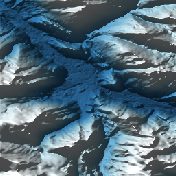
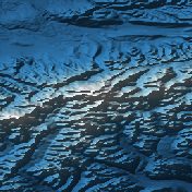
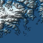
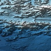
Matanuska Glacier, Alaska
A 40 km valley glacier you can reach by road, one of the largest in Alaska.
Terra Explorer Natural wonders
 Terra
Drag to rotate · scroll or pinch to zoom
Make this model
The Standard Resolution model is free as STL, 3MF, Colored 3MF, OBJ and a 16-bit heightmap. High Resolution samples the place about ten times more finely.
- Region
- Alaska, USA
- Position
- 61.7667, -147.6000
- Area
- 20 × 20 km
- Real elevation
- 456 to 2,645 m (2,189 m of relief)
- Printed size
- 150 mm (5.9 in) wide, about 1:133,300
- Heights
- 1.5× exaggeration
- Elevation data
- USGS 3D Elevation Program, 1–10 m per point
- Suggested color
- Glacier
- Group
- Natural wonders
Terrain facts: Matanuska Glacier
The ground around Matanuska Glacier is very steep. Across the 20 by 20 km area of the model, it runs from 456 m up to 2,645 m. That is 2,189 m of relief, about 3 times as tall as the Burj Khalifa.
- Flat 8.7%
- Gentle 21%
- Steep 30.3%
- Very steep 40%
On average the ground slopes at 25.9 degrees, and the steepest 1% is steeper than 59.3 degrees. About 9% of the area is flat (under 5 degrees) and about 70% is steep (over 15 degrees).
Out of 547 places in Terra, it ranks #75 for relief, #130 for highest ground and #55 for steepness (#1 is the most). Compare the places in Natural wonders →
Worked out by Embossify from USGS 3D Elevation Program data at about 78 m per point. The charts stretch the heights to fill the frame, and a single summit can read a little lower than its surveyed height.
Climate: Matanuska Glacier
The climate around Matanuska Glacier is cold: over the year the temperature averages about -5°C (23°F), from around -17°C (1°F) in January to around 9°C (49°F) in July. seven months average below freezing, so expect snow and ice. It is moderately wet, with about 707 mm (28 in) of precipitation in a year. June is the wettest month and February the driest.
The line is the monthly average. The shaded band runs from the average night-time low to the average daytime high.
Millimeters of rain, or of melted snow, in each month.
Color tip: Cold for much of the year, so the Glacier colors (deep blue to white) suit it. Choose it in Customize →
Climate averages for the area around this place, 2001 to 2025, from NASA POWER, adjusted for the height of the land. They describe the region, not the exact spot.
About Matanuska Glacier, Alaska
A 40 km valley glacier you can reach by road, one of the largest in Alaska.
Questions about Matanuska Glacier, Alaska
Where is Matanuska Glacier?
Matanuska Glacier is in Alaska, USA at 61.7667, -147.6000. The model covers a 20 by 20 kilometer square around that point.
How high is the terrain in the Matanuska Glacier model?
The land in this model runs from 456 to 2,645 m (2,189 m of relief), and its highest point is at 61.6952, -147.4280. These are the measured heights, printed 1.5 times taller so the shape is easy to see.
How steep is Matanuska Glacier?
On average the ground slopes at 25.9 degrees, and the steepest 1% is steeper than 59.3 degrees. About 9% of the area is flat (under 5 degrees) and about 70% is steep (over 15 degrees).
How does Matanuska Glacier compare with other places?
Out of 547 places in Terra, it ranks #75 for relief, #130 for highest ground and #55 for steepness (#1 is the most). For scale, that relief is about 3 times as tall as the Burj Khalifa.
Can I 3D print Matanuska Glacier?
Yes. Download the free Standard Resolution STL and print it on any FDM or resin printer. It is 150 mm wide and about 29.6 mm tall, on a solid 5 mm base, at a scale of about 1:133,300. It also works for CNC carving. Use Customize to change the width, base thickness or height exaggeration, make it round or add a name plate.
How accurate is the Matanuska Glacier model?
It is built from real elevation measurements: the USGS 3D Elevation Program, mostly airborne laser scans at 1 to 10 meters per point. Each point of the grid covers about 78 m on the ground, so a single summit can read a little lower than its surveyed height. The shaded picture on this page is made from the same data.
Is the Matanuska Glacier model free?
The Standard Resolution model is free as STL, 3MF, Colored 3MF, OBJ and a 16-bit heightmap. High Resolution samples the place about ten times more finely and is a paid upgrade.
How this model is made
Embossify Terra builds Matanuska Glacier, Alaska from real measured elevation. In the United States the heights come from the USGS 3D Elevation Program, mostly airborne laser scans that resolve every 1 to 10 meters.
The heights are exaggerated 1.5× so the shape is easy to see and feel; you can change that when you customize the model. The sea is flattened to zero, so land stands on a clean base. New to terrain printing? Read how Terra works.