
Embossify Terra builds a 3D-printable model of a real place from measured elevation data: a battlefield, a mountain, a canyon or your own street. This guide explains where the heights come from, what every control does, which settings suit which places, and how to get a good print. No geology degree required, though you will start sounding like you have one.
The short answer
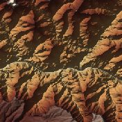 Grand Canyon10 km · 1× · Desert
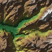 Half Dome10 km · 1× · Natural
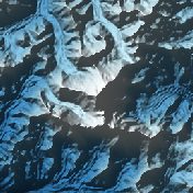 Mount Everest20 km · 1× · Glacier
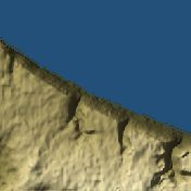 Omaha Beach5 km · 2× · War map
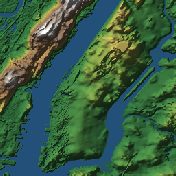 Manhattan10 km · 5× · Natural
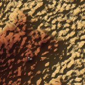 Giza Pyramids2 km · 2× · Desert
Each card opens that place’s page, where you can make its model with these settings. The Terra Explorer has hundreds more.
From heights to a solid model
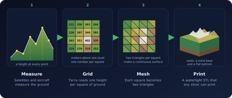
The elevation data is a grid of heights, one per square of ground. Terra turns each square into two triangles, then adds four straight walls and a flat bottom so the result is a solid block, the same kind of STL Embossify makes from pictures. The block is watertight, so any slicer will print it.
- Correct proportions. Degrees of longitude get shorter as you move away from the equator. Terra corrects for that, so a 5 km square on the ground is a square on your desk.
- Millimeters. The model is 100 to 250 mm wide (150 by default) on a solid base of 3 to 12 mm.
- One scale for everything. Width and height use the same scale, so hills keep their true proportions until you choose to exaggerate them.
Where the heights come from
Terra never invents terrain. Every height is a measurement, taken from a public elevation dataset:
| Where | Source | Detail |
|---|---|---|
| United States and territories | USGS 3D Elevation Program (3DEP), mostly laser scans from aircraft (lidar) | 1 to 10 meters per point, finer in many places |
| Everywhere else | Open Terrain Tiles: NASA SRTM, Copernicus (EU-DEM) and national surveys | About 30 meters per point |
The page tells you which source made your model. U.S. Geological Survey data is in the public domain; we credit it and the other providers on every model page.
The data describes the shape of the land. Buildings, bridges and trees are mostly not modeled, and with 30 meter data nothing smaller than about 30 meters can appear. Manhattan at 5× is a model of the island and its hills, not of its skyscrapers.
When the USGS service cannot be reached, Terra falls back to the worldwide 30 meter data and tells you so in a note under the preview. Press Generate again a minute later to get the full U.S. detail. Terra will not sell you a High resolution model built from the fallback.
Choosing a place
There are four ways to point Terra at a place. They all end in the same two numbers, a latitude and a longitude, and a square centered on that point.
- The library and the Explorer. More than 450 ready-made places: ancient wonders, castles and hilltop monasteries, natural wonders, canyons and waterfalls, mountains, volcanoes and craters, islands and coastlines, wild places, hikes, ski mountains and race tracks, famous battlefields, World War II sites, American history, cities, and mines, dams and mountain roads. Pick one on the Terra page, or open the Terra Explorer to browse them all with a 3D window, search, categories and a Surprise me button. Each has its own page with the story behind it. Library places are built once and kept, so they open instantly.
- Search any place by name. Type a mountain, a town or a landmark and press Find place. Terra suggests an area size that fits it (a small hill gets a few kilometers; a city or national park gets more). Place search uses OpenStreetMap data; results show the credit.
- Explore the map. A shaded-relief map of the whole world, drawn from the same elevation data. Drag to fly around, zoom in, and the square in the middle shows exactly what your model will cover. Press Use this spot.
- Paste a link or coordinates. Open the place in any map app, copy the address from the browser bar or press Share, and paste it. Terra understands Google Maps (including the short links), Apple Maps, MapQuest, OpenStreetMap and Bing, plain coordinates such as
36.1069, -112.1129, and degrees, minutes and seconds such as36°06'25"N 112°06'46"W.
Area: how much ground to cover
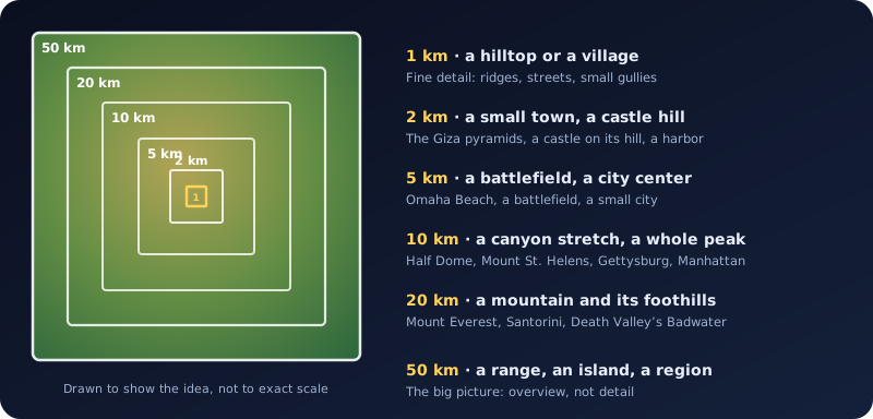
The area is the side of the square, in kilometers: 1, 2, 5, 10, 20 or 50. Every model prints at the width you choose, so a small area is a close-up with fine detail and a large area is an overview. Pick the smallest area that still holds what you care about; a 2 km square of the Giza plateau shows each pyramid, while 50 km of it would show only a desert.
Press Generate, look at the preview, then change the area and press Generate again. Library places already use the area that suits them.
Vertical exaggeration
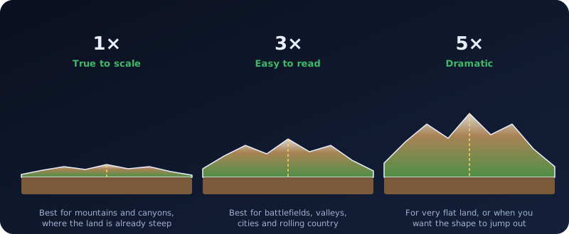
At true scale, most places are surprisingly flat. A 10 km square with 500 meters of hills is only 7.5 mm tall on a 150 mm print. Exaggeration multiplies the heights, up to 5× in half steps, so the shape is easy to see and feel.
| Kind of place | Try | Why |
|---|---|---|
| Tall mountains, canyons, volcanoes | 1× to 1.5× | They are already dramatic; more would look like spikes |
| Hills, ridges, coastal bluffs | 2× to 3× | Keeps the slopes believable while making them readable |
| Battlefields, river valleys, cities | 3× to 5× | The land is gentle; the small rises are what mattered |
| Nearly flat land | 5× | Without it the model looks like a plate |
Printed width and the solid base
| Setting | Choices | What it does |
|---|---|---|
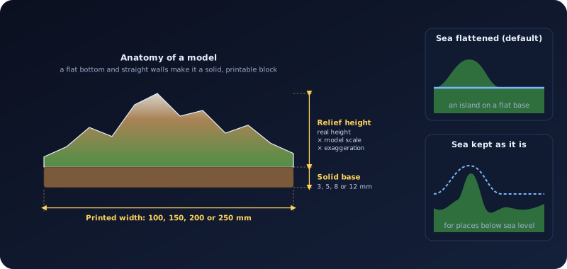
| Printed width | 100, 150, 200, 250 mm | How wide the model prints (the diameter, for a round model). 150 mm fits almost every printer bed; 250 mm needs a large one. |
| Solid base | 3, 5, 8, 12 mm | The flat slab under the lowest point of the land. 5 mm is a good default; 8 to 12 mm gives a sturdy plinth for display or for a name plate. |
The scale follows from the area and the width. On a 10 km square printed 150 mm wide, 1 mm of model is about 67 meters of ground, so a 1,000 meter mountain stands 15 mm above its base at 1× and 45 mm at 3×. The preview lists the exact printed size and height before you download.
Square or round, and a name plate
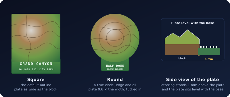
Outline. Terra makes a square block by default. Choose Round for a circular block: the elevation is sampled on rings around the center, so the edge is a true circle rather than a staircase, with a straight wall and a flat bottom. The model is as wide across as the printed width you pick. Round suits a mountain or an island that you want to display like a trophy.
Name plate. Tick Add a name plate to add a flat plate in front of the model, level with the base, with raised capital letters: the name you type (it starts as the place name) and, when it fits, a second line with the coordinates, the area in kilometers and the exaggeration. The letters stand 1 mm above the plate and are drawn in a plain block alphabet (letters, numbers and basic punctuation), at least 0.6 mm per dot, so a 0.4 mm nozzle prints them. If the coordinates line would be too small to print, it is left out instead of being cut short, and a long name is shortened to fit.
The plate and each letter are separate solid pieces that overlap the base slightly. Slicers merge them into one print. The plate is part of the STL, the 3MF and the OBJ, and it takes the lowest color in a Colored 3MF. The 16-bit heightmap PNG for CNC covers only the block: the plate is not in it, and for a round model the pixels outside the circle are black.
The ready-made places are built once and shared, so they are always square with no plate. Choose one, then switch on Round or the name plate and press Generate to make your own version.
Color
Terra colors the model by height, from the lowest ground to the highest peak. The colors show in the 3D preview. The Colored 3MF download carries them into slicers that support colored models (PrusaSlicer, Bambu Studio and others): the model is split into 16 height bands, each with its own color, and you can assign a filament to each. Printing in one color is just as good, and an STL never has color.
Smoothing and the sea
- Smoothing: None, Light or Strong. Light and Strong blur the heights slightly (one or two passes of a 3×3 average). Leave it on None for true detail. Use Light on the 30 meter worldwide data when the surface looks noisy or blocky, and Strong for a soft, sculpted look. Smoothing also lowers the very tallest peaks a little.
- Flatten the sea to zero. On by default: everything below sea level becomes flat, so an island or a coastline stands on a clean base instead of a bumpy seabed (the left drawing in the figure above). Turn it off for places that really are below sea level, such as Death Valley’s Badwater, or if you want the seabed.
Standard and High resolution
| Standard (free) | High resolution | |
|---|---|---|
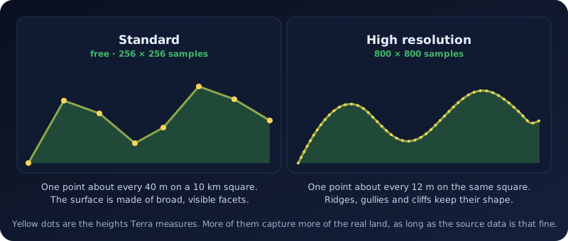
| Samples | 256 × 256 | 800 × 800 |
| Triangles | About 131,000 | About 1.3 million |
| Best for | Previewing, hills, mountains, gifts | Small areas, fine detail, large prints |
| Formats | STL, 3MF, Colored 3MF, OBJ, 16-bit heightmap | The same (OBJ only where the file is small enough) |
High resolution gains the most in the United States, where the source data is fine enough to show roads, buildings' footprints and small gullies on a 1 or 2 km square. Outside the United States the source is about 30 meters per point, so High resolution gives a smoother surface rather than new detail. The page says so before you decide.
How buying works. Generate a free Standard model first and check it in the preview. When you like it, choose Get High resolution, enter your email and pay. Terra then builds the full model in the background, which takes a few minutes, and prepares every format. The order page shows progress and then the downloads. Lost the page? Have your order links emailed again from the Find order page. The price is set for Terra and shown on the page.
Which file to download
| Format | Use it for |
|---|---|
| STL | Any slicer or CAM program. The safe choice for a single-color print or a CNC job. |
| 3MF | Modern slicers. A smaller, cleaner file than STL, with real units. |
| Colored 3MF | Multi-color printing: 16 height bands you can assign filaments to (see Color above). |
| OBJ | 3D programs and rendering. Not offered when the file would be very large. |
| 16-bit heightmap PNG | CNC routing and relief software that cuts from a picture. 16 bits give 65,536 height steps, far smoother than an ordinary 8-bit image. Black is the lowest point and white the highest; the picture note records the real meters. |
All formats hold the same model. 3D file formats: STL, 3MF, GLB, PLY, OBJ and heightmaps compares them in more detail.
Starting points for common places
- A famous mountain. 10 to 20 km, 1×, Natural or Glacier color, round outline with a name plate for a display piece.
- A canyon. 10 km, 1×, Desert color. Canyons are already deep.
- A battlefield or a ridge. 5 to 10 km, 3×, War map color. The small rises are what decided the fight.
- A city or harbor. 5 to 10 km, 3× to 5×, Natural color, sea flattened.
- An island. 20 km, 1.5×, sea flattened, a round outline looks great.
- A place below sea level. 20 km, 1×, Flatten the sea switched off.
- A fine-detail keepsake. 1 to 2 km in the United States, Standard resolution first, then High resolution for the print.
Printing tips
- Layer height. 0.12 to 0.2 mm shows the terrain well. Finer layers help on gentle hills.
- No supports needed. The model is a solid block with a flat bottom. Steep cliffs print fine because every layer rests on the one below it.
- Infill. 10 to 15 percent is plenty for a display piece.
- Finish. A light wash of dark paint wiped back with a dry brush brings out the contours. Painting by height is also fun with a colored 3MF as a guide.
- CNC. Use the STL, or the 16-bit heightmap PNG if your program cuts from a picture. A larger base (8 to 12 mm) leaves stock to hold the piece.
Good to know
Download the file you want right away. Free Standard resolution models are deleted after about a day, and paid models stay available for the time stated on your order page. Library places are kept and open instantly.
Either the area really is flat, or the area is large for its hills. Raise the exaggeration, or choose a smaller area. If a place is almost completely flat or all water, Terra tells you instead of building an empty plate.
Terra covers the Earth between 85° north and south. Visitors can make a limited number of new models per hour; the ready-made library places do not count against it. If Terra is busy making other models, try again in a moment.
Battlefields and history
Terrain decides battles. The bluffs above Omaha Beach, the ridge at Gettysburg, the hill at Monte Cassino and the black sand slopes of Iwo Jima all look different when you can hold them. Terra includes a collection of World War II and American history sites to start with, and any place on Earth works the same way. At 1× you see the land as the soldiers did; at 3× to 5× the slopes become easy to read.