Meteora, Greece
Monasteries on sandstone pillars, reached for centuries only by ladders and nets.
Terra Explorer Castles and hilltop monasteries
Drag to rotate · scroll or pinch to zoom
Make this model
The Standard resolution model is free as STL, 3MF, Colored 3MF, OBJ and a 16-bit heightmap. High resolution samples the place about ten times more finely.
- Region
- Greece
- Position
- 39.7217, 21.6306
- Area
- 5 × 5 km
- Real elevation
- 202 to 741 m (540 m of relief)
- Printed size
- 150 mm (5.9 in) wide, about 1:33,300
- Heights
- 2× exaggeration
- Elevation data
- Open satellite data (SRTM and others), about 30 m per point
- Suggested color
- Desert
- Group
- Castles and hilltop monasteries
About Meteora, Greece
Meteora (; Greek: Μετέωρα, pronounced [meˈteora]) is a rock formation in the regional unit of Trikala, in Thessaly, in northwestern Greece, hosting one of the most prominent complexes of Eastern Orthodox monasteries, viewed locally as second in importance only to Mount Athos. Their height is more than 20 metres (66 ft). Twenty-four monasteries were established atop the giant natural pillars and hill-like rounded boulders that dominate the local area, mainly from the second half of the 14th century under the local rule of self-proclaimed Emperor of Serbs, Greeks and Albanians, Simeon Uroš. As of December 2025, four of the original monasteries were occupied, in active use as monasteries that are managed by monks, and open to visitors: the monasteries of Great Meteoron (est. 1356), Varlaam, Holy Trinity, and Saint Stephen – the latter became a convent run by a community of nuns in 1961.
From Wikipedia: Meteora, text available under the Creative Commons Attribution-ShareAlike 4.0 license. The article’s history lists its authors.
Questions about Meteora, Greece
Where is Meteora?
Meteora is in Greece at 39.7217, 21.6306. The model covers a 5 by 5 kilometer square around that point.
How high is the terrain in the Meteora model?
The land in this model runs from 202 to 741 m (540 m of relief). These are the measured heights, printed 2 times taller so the shape is easy to see.
Can I 3D print Meteora?
Yes. Download the free Standard resolution STL and print it on any FDM or resin printer. It is 150 mm wide and about 37.4 mm tall, on a solid 5 mm base, at a scale of about 1:33,300. It also works for CNC carving. Use Customize to change the width, base thickness or height exaggeration, make it round or add a name plate.
How accurate is the Meteora model?
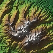
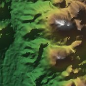
It is built from real elevation measurements, not an artist's guess: open satellite and survey data (NASA SRTM, Copernicus and national surveys), about 30 meters per point. The shaded picture on this page is made from the same data.
Is the Meteora model free?
The Standard resolution model is free as STL, 3MF, Colored 3MF, OBJ and a 16-bit heightmap. High resolution samples the place about ten times more finely and is a paid upgrade.
What is a Meteora terrain model good for?
People use it as a gift, a desk piece, or the base for a tabletop game or diorama.
About this terrain model
Embossify Terra builds Meteora, Greece from real measured elevation, not an artist's guess. Outside the United States the heights come from open satellite and survey data (NASA SRTM, Copernicus and national surveys), about 30 meters per point.
The model covers a 5 by 5 kilometer square centered on 39.7217, 21.6306. It prints 150 mm (5.9 in) wide on a solid base, a scale of about 1:33,300. The heights are exaggerated 2× so the shape is easy to see and feel; you can change that when you customize the model. The sea is flattened to zero, so land stands on a clean base.
New to terrain printing? Read how Terra works. The shaded picture on this page is made by Embossify from the same elevation data.