Kuelap, Peru
The cloud-forest fortress of the Chachapoya, about 3,000 m up.
Terra Explorer Ancient wonders
Drag to rotate · scroll or pinch to zoom
Make this model
The Standard resolution model is free as STL, 3MF, Colored 3MF, OBJ and a 16-bit heightmap. High resolution samples the place about ten times more finely.
- Region
- Peru
- Position
- -6.4186, -77.9244
- Area
- 5 × 5 km
- Real elevation
- 1,913 to 3,077 m (1,164 m of relief)
- Printed size
- 150 mm (5.9 in) wide, about 1:33,300
- Heights
- 2× exaggeration
- Elevation data
- Open satellite data (SRTM and others), about 30 m per point
- Suggested color
- Natural
- Group
- Ancient wonders
About Kuelap, Peru
Kuélap or Cuélap is a walled settlement located in the mountains near the towns of María and Tingo, in the southern part of the region of Amazonas, Peru. It was built by the Chachapoyas culture in the 6th century AD on a ridge overlooking the Utcubamba Valley.
From Wikipedia: Kuélap, text available under the Creative Commons Attribution-ShareAlike 4.0 license. The article’s history lists its authors.
Questions about Kuelap, Peru
Where is Kuelap?
Kuelap is in Peru at -6.4186, -77.9244. The model covers a 5 by 5 kilometer square around that point.
How high is the terrain in the Kuelap model?
The land in this model runs from 1,913 to 3,077 m (1,164 m of relief). These are the measured heights, printed 2 times taller so the shape is easy to see.
Can I 3D print Kuelap?
Yes. Download the free Standard resolution STL and print it on any FDM or resin printer. It is 150 mm wide and about 74.8 mm tall, on a solid 5 mm base, at a scale of about 1:33,300. It also works for CNC carving. Use Customize to change the width, base thickness or height exaggeration, make it round or add a name plate.
How accurate is the Kuelap model?
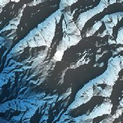
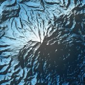
It is built from real elevation measurements, not an artist's guess: open satellite and survey data (NASA SRTM, Copernicus and national surveys), about 30 meters per point. The shaded picture on this page is made from the same data.
Is the Kuelap model free?
The Standard resolution model is free as STL, 3MF, Colored 3MF, OBJ and a 16-bit heightmap. High resolution samples the place about ten times more finely and is a paid upgrade.
What is a Kuelap terrain model good for?
People use it as a desk piece for history lovers, a classroom model or a gift for someone who has been there.
About this terrain model
Embossify Terra builds Kuelap, Peru from real measured elevation, not an artist's guess. Outside the United States the heights come from open satellite and survey data (NASA SRTM, Copernicus and national surveys), about 30 meters per point.
The model covers a 5 by 5 kilometer square centered on -6.4186, -77.9244. It prints 150 mm (5.9 in) wide on a solid base, a scale of about 1:33,300. The heights are exaggerated 2× so the shape is easy to see and feel; you can change that when you customize the model. The sea is flattened to zero, so land stands on a clean base.
New to terrain printing? Read how Terra works. The shaded picture on this page is made by Embossify from the same elevation data.