Fansipan, Vietnam
The roof of Indochina, at 3,143 m.
Drag to rotate · scroll or pinch to zoom
Make this model
The Standard resolution model is free as STL, 3MF, Colored 3MF, OBJ and a 16-bit heightmap. High resolution samples the place about ten times more finely.
- Region
- Vietnam
- Position
- 22.3033, 103.7750
- Area
- 10 × 10 km
- Real elevation
- 939 to 3,114 m (2,175 m of relief)
- Printed size
- 150 mm (5.9 in) wide, about 1:66,700
- Heights
- True to scale
- Elevation data
- Open satellite data (SRTM and others), about 30 m per point
- Suggested color
- Natural
- Group
- Mountains
About Fansipan, Vietnam
Fansipan (Vietnamese: Phan Xi Păng IPA: [fān.ʂī.pɐ̄ŋ], ) is a mountain in Vietnam. Its height was originally measured at 3,143 metres (10,312 ft) in 1909, but this value was later adjusted to 3,147.3 metres (10,326 ft). It is the highest mountain on the Indochinese peninsula (comprising Vietnam, Laos, and Cambodia), hence its nickname, "the Roof of Indochina". It is located in the Lào Cai province of the Northwest region of Vietnam, nine kilometres (5+1⁄2 miles) southwest of Sa Pa, in the Hoang Lien Son mountain range. Administratively, it is shared between Tam Đường District, Lai Châu and Sa Pa town.
From Wikipedia: Fansipan, text available under the Creative Commons Attribution-ShareAlike 4.0 license. The article’s history lists its authors.
Questions about Fansipan, Vietnam
Where is Fansipan?
Fansipan is in Vietnam at 22.3033, 103.7750. The model covers a 10 by 10 kilometer square around that point.
How high is the terrain in the Fansipan model?
The land in this model runs from 939 to 3,114 m (2,175 m of relief). These are the measured heights, printed true to scale.
Can I 3D print Fansipan?
Yes. Download the free Standard resolution STL and print it on any FDM or resin printer. It is 150 mm wide and about 37.6 mm tall, on a solid 5 mm base, at a scale of about 1:66,700. It also works for CNC carving. Use Customize to change the width, base thickness or height exaggeration, make it round or add a name plate.
How accurate is the Fansipan model?
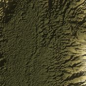
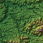
It is built from real elevation measurements, not an artist's guess: open satellite and survey data (NASA SRTM, Copernicus and national surveys), about 30 meters per point. The shaded picture on this page is made from the same data.
Is the Fansipan model free?
The Standard resolution model is free as STL, 3MF, Colored 3MF, OBJ and a 16-bit heightmap. High resolution samples the place about ten times more finely and is a paid upgrade.
What is a Fansipan terrain model good for?
People use it as a memento of a climb, a gift for a mountaineer or a ski-trip souvenir.
About this terrain model
Embossify Terra builds Fansipan, Vietnam from real measured elevation, not an artist's guess. Outside the United States the heights come from open satellite and survey data (NASA SRTM, Copernicus and national surveys), about 30 meters per point.
The model covers a 10 by 10 kilometer square centered on 22.3033, 103.7750. It prints 150 mm (5.9 in) wide on a solid base, a scale of about 1:66,700. The heights are true to scale. The sea is flattened to zero, so land stands on a clean base.
New to terrain printing? Read how Terra works. The shaded picture on this page is made by Embossify from the same elevation data.